ClearGuide combines real-time and predictive analytics to support all phases of emergency preparedness and response.
Before Landfall
- Analyze historical data to identify and program alerts for high-risk areas.
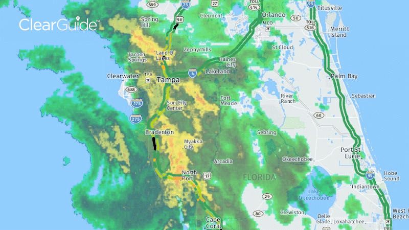
- Monitor evacuation routes and the predicted storm path in real time.
Tropical Storm Elsa, Florida (statewide) – July 7, 2021
During Hurricane
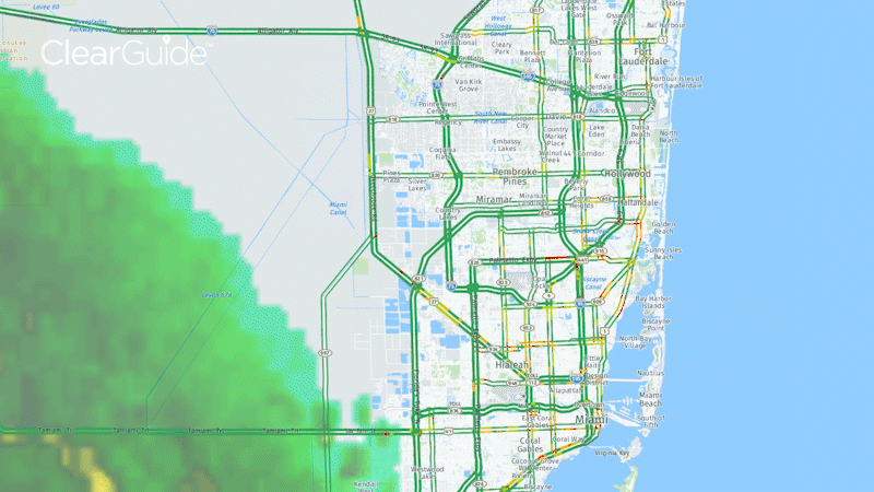
- Monitor rainfall, windspeed and traffic conditions in real time on one platform.
Tropical Storm Elsa, Miami, Florida – July 6, 2021
Post Hurricane
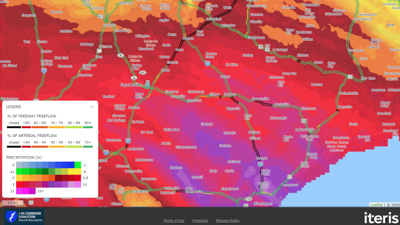
- Identify heavily impacted locations.
- Measure back-to-normal conditions and effectiveness of overall response.
Hurricane Florence, the Carolinas – September 2018
Contact an expert using the form on this page and we will be in touch.